

Park · Edinburgh · ⭐ 9.7/10 · 12814 reviews · updated: 2026-08-04 20:19:48
Address: Queen's Dr, Edinburgh EH8 8HG, United Kingdom
Holyrood Park — a royal hunting ground with a volcano in it
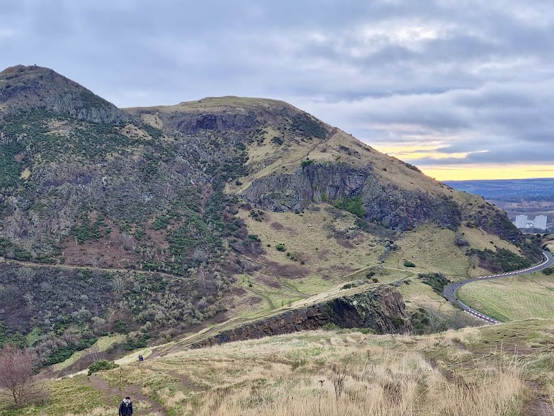
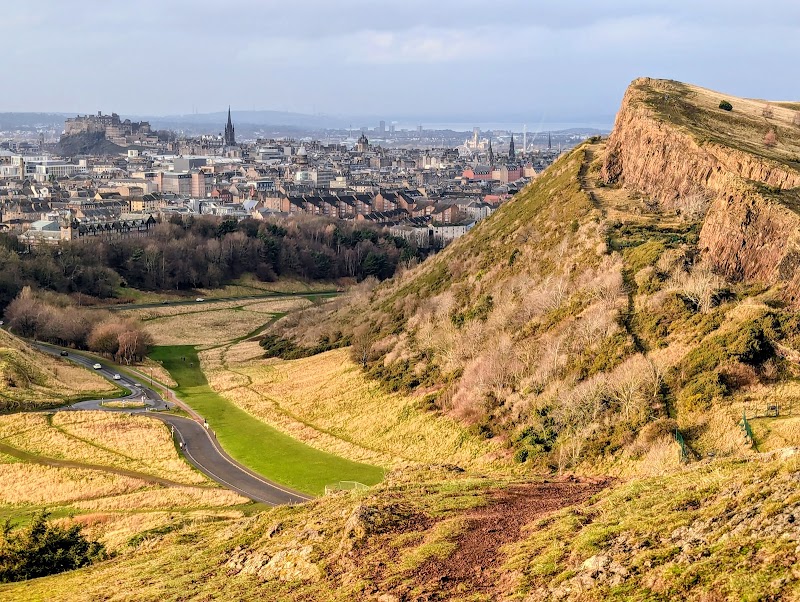
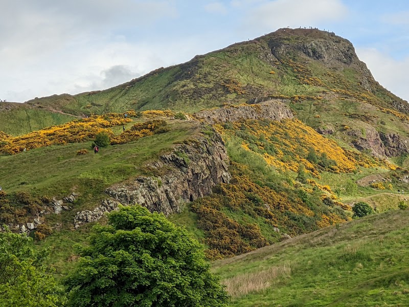
No other European capital keeps a 251-metre extinct volcano inside its boundary and treats it as an ordinary park. Holyrood Park covers some 650 acres (260 ha) of hill, crag, bog and loch barely a mile east of Edinburgh Castle, and its skyline — the lion-shaped bulk of Arthur’s Seat with the sheer red-brown wall of Salisbury Crags in front of it — is visible from half the city. Walk in from the palace end and within ten minutes the traffic noise is gone, replaced by wind, skylarks and the sound of your own breathing on the climb. It has been a royal park since 1541, a scheduled monument in its entirety since 2013, and a place where geology as a science was partly invented. It is also, on any dry evening, full of students, dog walkers and people carrying a beer up a mountain.
Highlights
- Arthur’s Seat — the 251 m (823 ft) summit of an extinct volcano that erupted roughly 340–350 million years ago in the Carboniferous, later scraped and shaped by ice. The gentlest approach is the grassy eastern slope from near Dunsapie Loch; the summit view runs from the Firth of Forth and Fife to the Pentland Hills.
- Salisbury Crags — a curving cliff of dolerite and columnar basalt roughly 46 m high, forming the park’s dramatic western face. The rock here was quarried in the early nineteenth century, and the scars are still legible from the city below.
- Hutton’s Section — the exposure on the Crags where James Hutton, born in Edinburgh on 14 June 1726 and later called the father of modern geology, found molten rock forced into older sediments. It became key evidence for an Earth vastly older than anyone then supposed.
- St Anthony’s Chapel — a gaunt ruin on a shelf above St Margaret’s Loch, standing by the early fifteenth century and recorded in a papal document about repairs in 1426. Only the north wall and a fragment of the west wall survive of a building once about 43 by 18 feet with three-foot walls and a tower over 39 feet high.
- Duddingston Loch — the park’s natural loch, fringed with reedbeds, brought into the royal park in 1923 and declared a bird sanctuary in 1925. Curling was played on its ice from at least 1761, and Raeburn’s famous painting of a skating minister is bound up with the loch’s legend.
- Samson’s Ribs and the hill forts — a spectacular colonnade of columnar basalt on the southern flank, and four prehistoric fortified sites within the park, on Arthur’s Seat, Salisbury Crags, Samson’s Ribs and Dunsapie Hill, with cultivation terraces still ridging the eastern slopes.
What you’ll find
The park is a compressed piece of Highland landscape dropped into a city: three summits, a marshy hollow, three bodies of water, a ruined chapel, a holy well and a circuit road built for Victorian carriages. Distances are short but the ground is genuinely steep, rough and exposed in places, and the weather at the top is not the weather at the bottom.
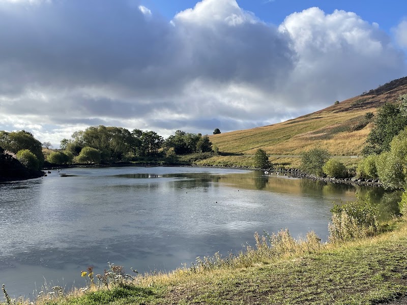
- Three lochs of very different character — man-made St Margaret’s Loch, created in 1856 as part of Prince Albert’s improvements and thick with swans and gulls; Dunsapie Loch, another artificial sheet tucked high on the eastern side; and natural, reed-fringed Duddingston Loch.
- Hunter’s Bog, a long marshy valley between the ridges that drains towards St Margaret’s Loch — quiet, sheltered and often empty even when the summit path is busy.
- St Margaret’s Well, a fifteenth-century vaulted well house that was dismantled at Restalrig and rebuilt here in 1860 when a railway depot took its original site, and St Anthony’s Well, a spring below the chapel.
- The subsidiary tops and shoulders — Whinny Hill, Crow Hill, Nether Hill, Haggis Knowe and Dunsapie Hill — which give short, satisfying climbs for anyone not attempting the main summit.
- A carriage drive circling the whole park, laid out from 1844 as part of Prince Albert’s reordering of the royal park, and now progressively given over to walkers, runners and cyclists.
- Ravens, peregrines, fulmars on the crags, skylarks over the grassland, and gorse that turns the lower slopes yellow and coconut-scented in spring.
Things to do — and who it’s for
- Ambitious first-time visitors — the summit of Arthur’s Seat, the single best panorama in Edinburgh, earned in forty minutes to an hour of real uphill walking rather than bought with a ticket.
- Casual walkers and families — the near-level circuit around St Margaret’s Loch and up to the chapel ruin gives ruins, water, birds and a view for a fraction of the effort.
- Runners and cyclists — the circuit road is a long, punishing, spectacular loop with no junctions, and the weekend closures to through traffic make it a genuinely different experience from riding on city streets.
- Geology and history enthusiasts — few places on Earth carry as much scientific weight per hectare; Hutton’s evidence, the hill forts, the terraces and the chapel are all within one walk.
- Birdwatchers — Duddingston Loch’s reedbeds and the crag ledges support species you would not expect within a capital city, and the loch has been protected since 1925.
- Photographers and sunrise chasers — the eastern approach faces the Firth of Forth, which makes the summit a well-known and well-populated place to watch the sun come up.
Getting there & practical
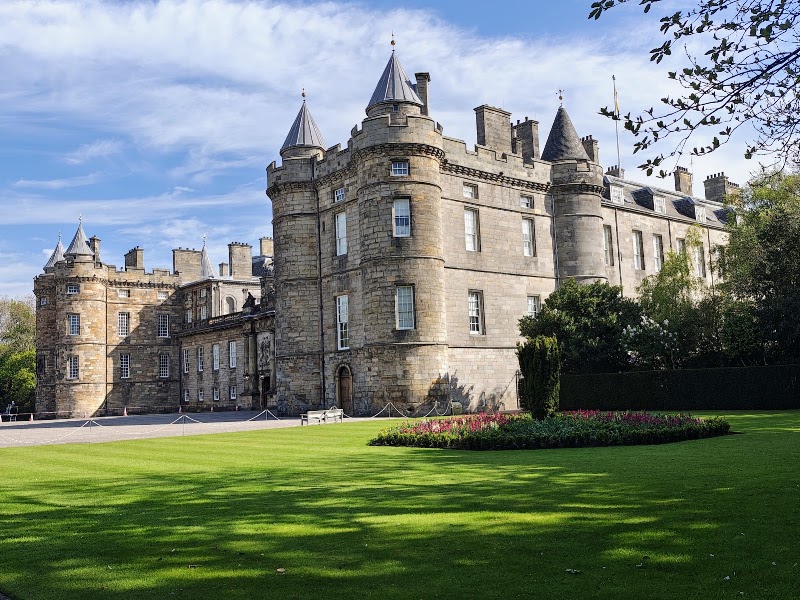
The park occupies the eastern edge of the city centre, immediately behind the Palace of Holyroodhouse and the Scottish Parliament, and spreads south-east towards the old village of Duddingston and the Royal Commonwealth Pool. It is walkable from Waverley station in fifteen to twenty minutes. Lothian services 35 and 36 stop at the Scottish Parliament, a few hundred metres from the northern entrance; services 2, 14, 30 and 33 serve the Royal Commonwealth Pool on the south-western side, which is the closest approach to the crags. There is no admission charge and no gate: the park is open all year, day and night, and is managed by Historic Environment Scotland on behalf of Scottish Ministers. Access by car is a different matter and changes often. Park roads are closed to through traffic every Saturday and Sunday, and on Christmas Day, Boxing Day and New Year’s Day; the high road is closed to motor vehicles except in daytime hours from Tuesday to Thursday; and the low road towards Duddingston has been shut since March 2026 because of the risk of rockfall at Samson’s Ribs. Allow ninety minutes to two hours for the summit round trip, and check the current access notices before planning a route, because closures here are genuinely dynamic.
When to visit
Spring is the park at its best: gorse in flower across the lower slopes, skylarks up over the grassland, and the ground drying out after winter. Summer brings long light — you can climb at nine in the evening in June and still descend in daylight — and August floods the whole city with the Festival and the Fringe, at which point the summit becomes the standard escape valve for anyone who has seen four shows and needs to look at the horizon. Autumn is the connoisseur’s season: clear cold mornings, mist sitting in Hunter’s Bog, low sun on the Crags and far fewer people on the paths. Winter is serious. Days are short, the summit ridge is fully exposed, and the grass and rock become slick and often icy — but a hard frost with the Firth of Forth glittering below is the finest view the park ever gives, and on 31 December the Hogmanay fireworks over the Castle can be watched from the hill instead of from the crowds. In any season, remember that this is a real hill: it can be pleasant at the palace and blowing hard on the ridge.
Good to know
The park was formally enclosed in 1541, when James V had the ground around Arthur’s Seat, Salisbury Crags and the Duddingston crags walled in as a royal hunting park; it was extended in January 1542 with lands at Duddingston bought from David Murray of Balvaird. Ownership still rests with Scottish Ministers, and Historic Environment Scotland has managed the site since; in 2013 the entire park, except its occupied buildings, was designated a scheduled monument. Long before the kings, people lived here: four prehistoric forts crown the high ground, and the terraces cut into the eastern slopes are the fields of an early farming community. Later centuries added their own layers. Dunsapie Loch hosted festivities in 1562 for the wedding of John, Lord Fleming, including a staged mock siege of Leith; in 1595 John Skene reckoned the park’s grazing at eight hundred wethers and four hundred ewes; in October 1720 Nicol Muschat murdered his wife Margaret Hall in the park, a crime marked by a cairn raised in 1823 and renamed in 2024 to commemorate the victim rather than the murderer. On 7 August 1860 around 21,000 volunteer soldiers paraded here before Queen Victoria and Prince Albert, watched by a crowd counted in the hundreds of thousands. In 1970 the park hosted the cycling road race of the British Commonwealth Games. The Radical Road along the base of the Crags is its own story: it was paved after the Radical War of 1820 to give work to unemployed weavers from the west of Scotland, at the suggestion of Walter Scott, and it has been closed since a large rockfall in September 2018. Historic Environment Scotland has been working towards a partial reopening of the section between the Hawse and the north end of the South Quarry, timed around the tercentenary of James Hutton’s birth in June 2026 — but the path should be treated as closed unless signage on site says otherwise. Rock climbing is likewise restricted, permitted only in the South Quarry and only with a free permit; the tradition here goes back to Harold Raeburn and W. Inglis Clark around 1900.
Visitor tips
- For the easiest ascent of Arthur’s Seat, start from the eastern side near Dunsapie Loch — it removes a large share of the height gain and turns a scramble into a walk. The steep direct route from the palace side is much harder than it looks from below.
- Wear proper shoes. The worn basalt on the summit approaches is polished and slippery even when dry, and lethal when wet; a great many ankle injuries here happen to people in smooth-soled trainers.
- Check the current closure notices before you set out. The Radical Road, the low road towards Duddingston and parts of the circuit road have all been shut at various points, and routes described in older guidebooks may no longer exist on the ground.
Questions & answers
Is Arthur’s Seat really a volcano? It is the deeply eroded remnant of one. The volcano was active roughly 340–350 million years ago in the Carboniferous period, and has been extinct ever since; glaciers later stripped it back to the hard core you climb today. There is no possibility of eruption.
How hard is the climb, and how long does it take? Most reasonably fit people reach the 251 m summit in forty minutes to an hour from the lower car parks, and the round trip takes ninety minutes to two hours. It is a hill walk, not a mountaineering route, but it is steep, rocky and exposed at the top.
Is the Radical Road open? It has been closed since a substantial rockfall in September 2018. Historic Environment Scotland has been preparing a partial reopening of one section, but access depends on the safety works being completed and signed. Treat the path as closed unless signs at the site say otherwise, and never duck under a barrier on the Crags.
Can I drive through the park? Only partly, and less than you might expect. The park roads close to through traffic every weekend and on the main winter holidays, the high road is open to motor vehicles only in daytime hours on Tuesdays to Thursdays, and the low road towards Duddingston has been closed since March 2026 because of rockfall risk. There are car parks, but walking or the bus is far simpler.
Is there an entry fee or an opening time? No fee, and no closing time — the park is open all year and does not lock. Only the roads and specific paths are subject to restrictions.
What is the ruin on the hill above the loch? St Anthony’s Chapel, in place by the early fifteenth century and mentioned in a papal record of repairs in 1426. Only the north wall and part of the west wall stand; the original building was roughly 43 by 18 feet with a tower over 39 feet high, and it appears on Richard Lee’s sketch plan of Edinburgh from 1544.
Can I swim in the lochs? No. Duddingston Loch is a protected bird sanctuary with fragile reedbeds, and St Margaret’s and Dunsapie are shallow artificial lochans with silted, unsafe beds. Swimming is not permitted.
Are dogs allowed? Yes, and the park is a favourite with local dog walkers, but dogs should be kept under close control near the cliff edges, around the ground-nesting birds of the grassland in spring and early summer, and beside the loch shores where wildfowl gather.
Photos
Show 1 more photos
Visitor reviews
Reviews last updated: 2026-08-04 20:19:48
Data is refreshed monthly. Sources: edinburghname.com and editorial picks based on reviews.
Very beautiful, but there aren't enough signs showing exactly which way to go.
A huge park not far from the city centre. There are several paths of varying difficulty. From completely easy ones to almost vertical. A huge space for your pets. From the top a view of the city opens up. However, if you…
A wonderful park, You can climb to the top and from it see the whole of Edinburgh in 360 degrees
These are the ruins of a former volcano. the volcano was destroyed by a glacier. gorgeous views, very reminiscent of the Carpathians, Zakopane in Poland.
An incredible place for reflection and quiet alone with beautiful views.